Wildfire Early Detection · Veteran-Founded

See the fire before it becomes the fire.

Air Aware Technologies designs, integrates, and supports AI-driven wildfire detection, fuels mapping, and wildland fire situational awareness for fire agencies, counties, and communities across the Mountain West.

90%+Slash pile detection performance in validation testing
300+ fpsModel speed on a low-cost edge AI computer, no cloud required
ArcGIS nativeDetections land directly in your existing ArcGIS Online layers
The Problem

Small agencies, big terrain, short windows.

Mountain fire districts cover huge wildland-urban interface areas with limited staff. The first minutes after ignition decide whether a start stays a spot fire or becomes a campaign fire.

Solutions

Detect. Map. See. Connect.

We are a systems integrator first. We select proven hardware and software, engineer the site, and hand your team a working system rather than a science project.

Available

Camera Early Detection

Commercial PTZ cameras on ridgelines and towers, paired with AI smoke and flame detection that watches around the clock and pushes alerts with imagery to your dispatch and duty officers.

  • Site survey, viewshed analysis, and tower siting
  • Enterprise-grade cameras and AI detection software
  • Alerts with bearing, imagery, and map location
  • Installation, training, and ongoing support

Built on long-range PTZ cameras such as the AXIS Q6225-LE: 1080p, 31x optical zoom, rated -50 to 55 °C and 152 mph winds.
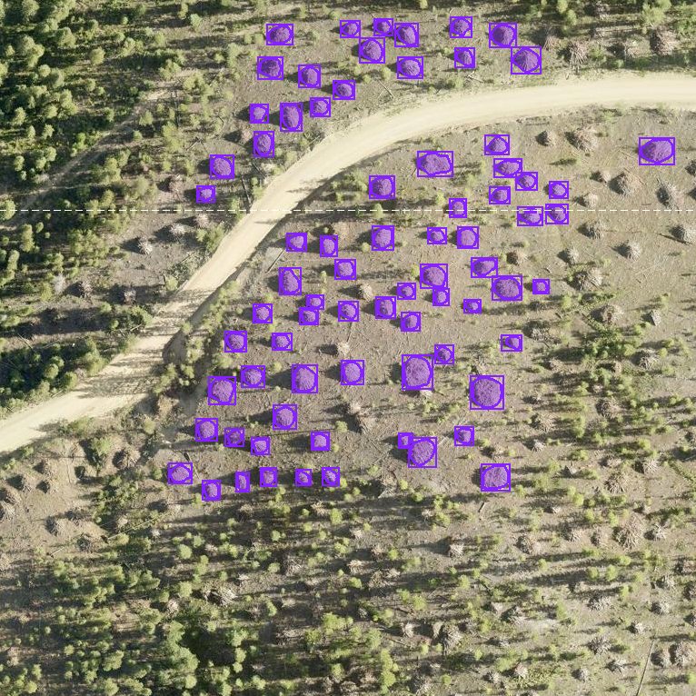
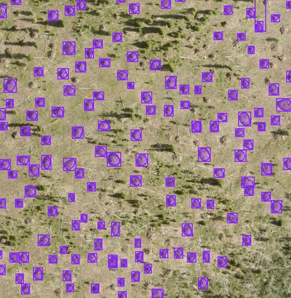
Aerial imagery with detected slash piles outlined
Available

Slash Pile Mapping

Computer vision that scans aerial imagery to find and inventory slash piles, then writes every detection straight into your ArcGIS Online layers for burn planning.

  • Custom-trained detection model
  • Runs on low-power edge hardware
  • Direct ArcGIS feature layer integration
  • Tracks piles from cut to burned
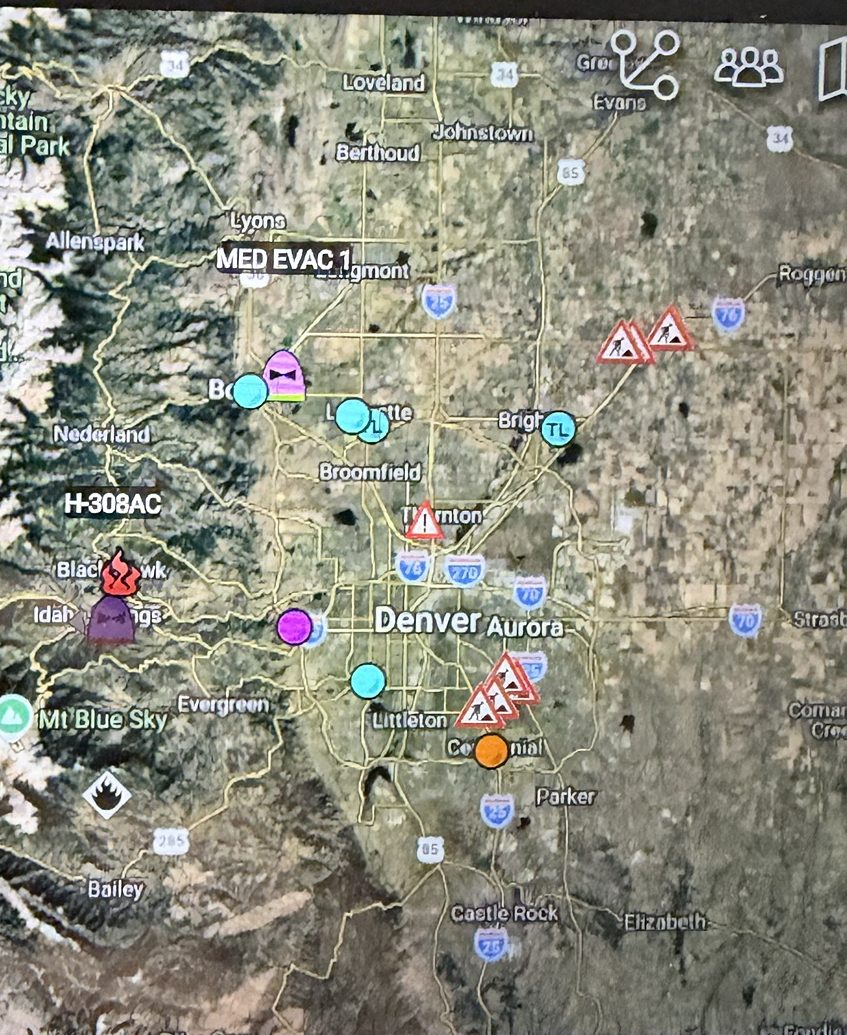
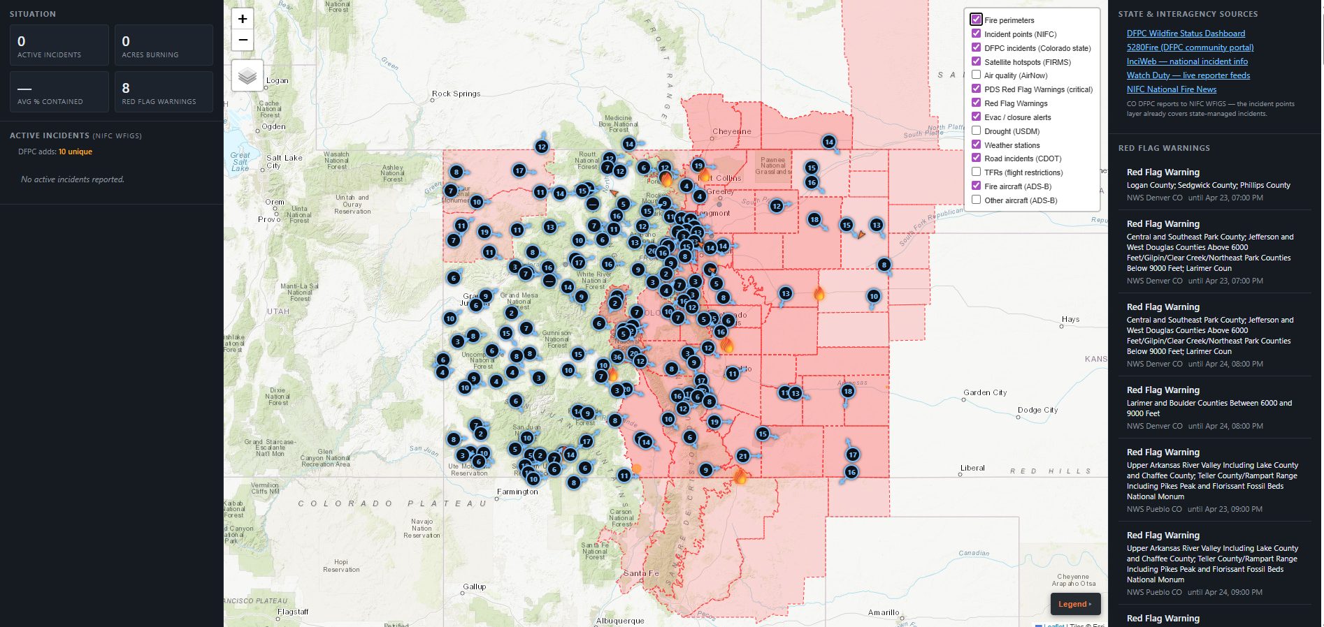
Anchor Point common operating picture
Beta

Anchor Point

A wildland fire common operating picture that pulls national and state incident data, weather, and airspace into one live map for chiefs and emergency managers.

  • Incidents, perimeters, and satellite hotspots
  • Red flag warnings and fire weather stations
  • Fire aircraft tracking and flight restrictions
  • Road closures and evacuation alerts
In Development

FireMesh

Self-healing mesh networking that carries camera, sensor, and responder data across terrain where cell and fiber do not reach.

  • Backhaul for remote cameras and sensors
  • Solar-powered, low-maintenance nodes
  • Multiple WAN paths for resilience
  • Scales from a single valley to a county
Roadmap

FireEye Aerial ISR

Long-endurance fixed-wing unmanned aircraft for reconnaissance over active incidents and post-ignition patrol of high-risk areas.

  • Extended-range fixed-wing platform
  • Live HD video downlink to the incident
  • Perimeter and hotspot mapping
  • Pairs with ground cameras for confirmation
How It Works

From first wisp of smoke to boots moving.

Watch

Cameras sweep assigned terrain continuously, day and night, in every season.

Detect

AI flags smoke or flame in the imagery and estimates a location.

Verify

An alert with images and map position lets a person confirm quickly.

Respond

Dispatch and duty officers get the location and imagery on the phones and GIS tools they already use.

Field Work

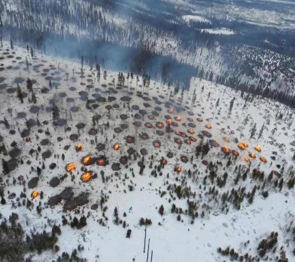
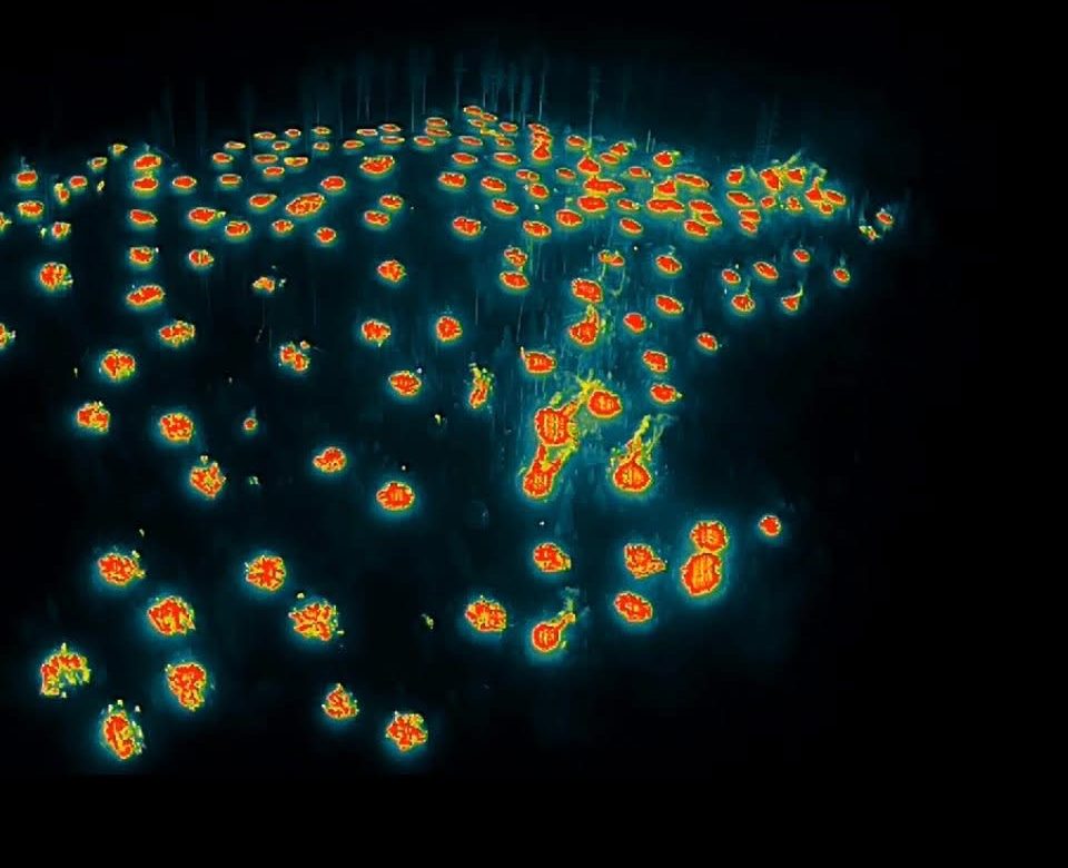
Slash pile mapping for a mountain fire chiefs association.

Built and demonstrated for a group of local wildland fire chiefs who needed a faster way to know where cut piles were, and which had been burned.

Model detections of individual slash piles on aerial imagery
Each box is one pile the model found.
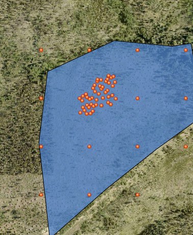
Study area polygon in ArcGIS with detected pile points
Detections written to an ArcGIS study area layer.

The problem

Slash piles from years of fuels treatments, tracked by memory and paper. Crews could not easily see what was left to burn or plan burn windows around it.

What we built

A custom-trained computer vision model that scans county aerial imagery on a small edge computer and writes every pile it finds, with location and status, into the association's ArcGIS Online account.

90%+detection performance in validation
300+ fpsmodel speed on edge hardware
$0ongoing cloud compute cost
ArcGISno new software for crews to learn

The result

A map-based pile inventory in ArcGIS that can be filtered by area and status, and a platform we are extending to other fuels and detection work.

Funding

We help you pay for it.

Early detection is eligible for federal and state wildfire mitigation funding, but only if it is written into your planning documents first. We work with agencies from planning through grant application.

  1. Plan. Get early detection named in your Community Wildfire Protection Plan (CWPP).
  2. Scope. We produce the site plan, coverage maps, and cost estimate.
  3. Apply. Support for Community Wildfire Defense Grant (CWDG) and state program applications.
  4. Deploy. Installation, training, and sustainment once funding lands.
For Agencies

Doing business with Air Aware.

Everything your purchasing office will ask for, in one place. Download the one-page capability statement for your files.

Company

  • NameAir Aware Technologies LLC
  • TypeVeteran-founded small business

NAICS Codes

  • 541330Engineering Services
  • 541512Computer Systems Design
  • 334511Detection & Navigation Systems
  • 541690Technical Consulting

How to Buy

  • Direct purchase by agency or district
  • Grant-funded procurement (CWDG, state programs)
  • Through integration partners
Download Capability Statement
Documents

Request product sheets and documents.

Pick what your team, board, purchasing office, or grant application needs and we will send it directly.

Product sheets

Product sheets are sent on request. Click a sheet to add it to your request, then fill in the form.

Request documents

Product sheets

Purchasing and planning

We reply by email, usually within one business day. See our privacy policy.

FAQ

Questions chiefs ask us.

What does a camera detection system cost?

Every site is different. Cost depends on the number of cameras, tower and power availability, and connectivity. After a site survey we provide a written estimate that covers hardware, installation, software subscription, and support, formatted so it can drop straight into a grant application.

Do we buy it or subscribe to it?

Hardware is typically a one-time purchase and the AI detection software is an annual subscription. We work with you to structure it around your budget cycle or grant rules.

What power and connectivity does a site need?

Grid power is simplest, but solar with battery works for remote sites. For connectivity we use whatever is reliable at the location: fiber, cellular, satellite, or point-to-point radio. Where none of those reach, that is what FireMesh is for.

Who watches the alerts?

The AI watches continuously. When it detects smoke it sends an alert with imagery to the people you designate, such as dispatch, duty chiefs, or both. A person confirms before anyone rolls.

What about false alarms?

Every alert includes the image that triggered it, so a false alarm takes seconds to dismiss. During setup we account for each camera's view, including known smoke sources like chimneys and planned burns.

Who owns the data?

Your agency's map layers and detections are written into your own accounts, such as ArcGIS Online. Data terms for each system are spelled out in your agreement before you buy.

What happens after installation?

We train your team at handoff and offer ongoing support options, scoped to your system and budget.

Can you help with the grant application?

Yes. We help get early detection into your CWPP, then provide the technical scope, coverage maps, and budget for Community Wildfire Defense Grant and state applications.

About

Built in the mountains we protect.

Air Aware Technologies started by working directly with local wildland fire chiefs to understand what they actually need, then built and demonstrated systems against those needs.

We bring defense-grade systems engineering discipline to a problem that has historically been underserved by technology: finding small fires fast, in rugged terrain, on a small agency budget.

Aspen and pine forest on a mountain slope at sunrise
KC
Founder

Kevin Carfagno

Systems engineer with a background in counter-UAS, RF and software-defined radio, edge computing, and electronic warfare. Former program manager on a federal counter-drone program. Marine Corps veteran and PMP.

USMC VeteranPMPSystems EngineeringRF / SDREdge AIGIS Integration
Contact

Request a briefing.

Fire agency, county, landowner, or potential partner? Tell us about your coverage area and we will set up a call.

We reply by email, usually within one business day. See our privacy policy.